
The rural to urban exodus is well known. It has driven the growth of the largest urban areas from one million residents as late as 1800 to nearly 40 million today. The United States has risen from less than 40 percent urban in 1900 to more than 80 percent today. Other, more affluent nations have experienced similar trends. Even more quickly, China has risen from 19 percent urban in 1980 to 56 percent in 2015 today, according to the United Nations. Even the least affluent nations are urbanizing rapidly.
The Defining Trend: Metropolitanization, not the Rural to Urban
But the trend reflective of urbanization is the movement of people into metropolitan areas, which include traditional (core) city, suburban and even rural areas. This might best be called “metropolitanization.”
According to the US Office of Management and Budget, a metropolitan area is “a geographic entity associated with at least one core … plus adjacent territory that has a high degree of social and economic integration with the core as measured by commuting ties" (Note 1). The core is the largest urban area in the metropolitan area. The peripheries of metropolitan areas, outside the largest urban areas, are largely rural by the Census Bureau definition. In 2010, the majority of the nation’s rural population lived in metropolitan areas, while 90 percent of metropolitan land area was rural. Despite living areas formally designated as rural, residents in the metropolitan periphery more often live an urban, rather than rural lifestyle.
Cities, in the economic sense, are metropolitan areas, which can also called "functional cities" or "economic cities." By this is not meant any jurisdictional definition, such as the city of New York or the ville de Paris, but rather the entire area of economic integration generally defined by work trip commuting. Former principal planner of the World Bank Alain Bertaud has shown that in this sense, cities are labor markets.
There is considerable confusion, however, about the commuting that defines a metropolitan area. Many people think of the city as monocentric, with most of the employees working in a central business district (downtown). Yet all of the major US metropolitan areas are more decentralized than monocentric or even polycentric (this includes New York, with the world’s second largest central business district).
Metropolitan areas are defined by commuting to or from central counties, which encompass most, if not all of the largest urban area. Thus, the New York metropolitan area is not determined by commuting to Manhattan or even commuting to the city of New York. The New York urban area is so extensive that, for example, Ocean and Mercer counties in New Jersey as well as Westchester, Nassau and Ulster counties in New York are central counties. Commuting to any of these (and many other) counties counts toward their inclusion in the metropolitan area.
Over the past century or more, the United States has transitioned from a non-metropolitan to a metropolitan country.
1900: Non-Metropolitan America
Until the late 19th century, there was only limited commuting from beyond the urban periphery to cities. By 1900, not only had improved mass transit spurred development outside the city limits, but the automobile was about to make longer commutes possible, saving time in the process, and making access to more of the metropolitan district possible. For practical purposes, the 1900 census was the last of the pre-automobile era, with only 8,000 cars registered across the nation. By 1910, the number had increased to 450,000, and more than 8,000,000 by 1920. According to economist Robert Gordon, 90 percent of the world's registered motor vehicles were in the United States by 1930 (Note 2).
In response to these trends, the US Census Bureau began designating “metropolitan districts” in the 1910 census. These metropolitan areas had urban core municipalities of at least 50,000 residents.
A 1948 Census Bureau publication (The Growth of Metropolitan Districts in the United States: 1900-1940) produced retrospective estimates of population for the 39 metropolitan districts with more than 100,000 population in 1900. These metropolitan districts had a population of 19 million. There were 59 million US residents outside the metropolitan districts.
Early metropolitan America was much different than today (Table).
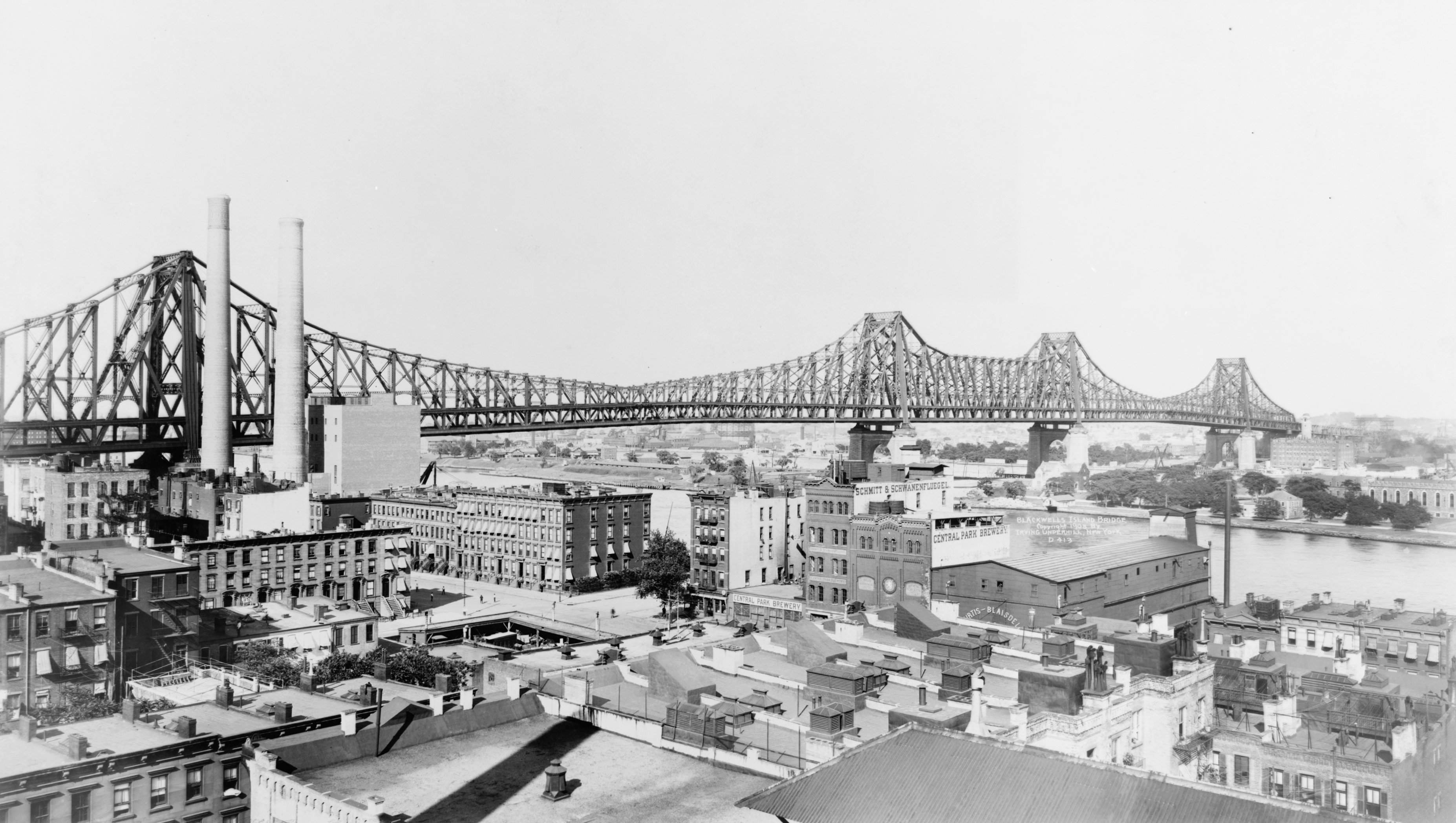
New York was the largest metropolitan district in the nation, with 4.7 million residents, 3.4 million of whom lived in the city of New York. At that time, there was plenty of greenfield space in the outer boroughs to accommodate the more than 150 percent increase that occurred in the ensuing decades (see 1908 bird's eye view from the David Rumsey Map Collection).
Chicago was the second largest, with 1.8 million residents, more than 90 percent of whom lived in the city of Chicago. Philadelphia had 1.6 million residents, with 80 percent in the core city. Boston had 1.2 million residents, but suburbanization was well on its way, with only 44 percent of the population in the core city.
Los Angeles, which has been the nation's second largest metropolitan area since 1960, had 123,000 residents in 1900, 35th largest of the 39. Dallas-Fort Worth and Houston, now ranked 4th and 5th largest, did not achieve metropolitan status until 1920. Now seventh ranked Miami had to wait until 1930 for metropolitan status.
Two 1900 vintage metropolitan districts have become part of larger metropolitan areas. Lowell, Massachusetts was combined into Boston, while Fall River, Massachusetts became a part of the Providence metropolitan area.
Scranton--Wilkes-Barre, Pennsylvania has grown particularly slowly and has fallen from 13th largest in 1900 to 100th largest in 2018.
2010: Metropolitan America
Between 1900 and 2010, the number of metropolitan areas increased to nearly 10 fold (383). Their population had risen by 263 million, more than 13 times their 1900 population. Meanwhile, the number of residents living outside the metropolitan areas dropped 13 million to 46 million (Figure 1). In 2010, 85 percent of the nation's population was in metropolitan areas, up from 25 percent in 1900. If the metropolitan areas with smaller urban cores are counted, only six percent of the nation (or 18 million people) is non-metropolitan.

Metropolitanization has also meant growing suburbs and exurbs. By 2010, metropolitan areas with more than 1,000,000 population had only 26 percent of their population in the historical core municipalities. By contrast, among the 32 metropolitan districts corresponding to today's metropolitan areas with more than 1,000,000 residents, the historical core municipalities had 80 percent of the population in 1900.
Metropolitanization is continuing. Between 2010 and 2018, 99.5 percent of US growth has been in metropolitan areas. This should not be surprising, because so much of America’s economy is in this all-encompassing sector of the nation, with 85 percent of the GDP produced in the hundreds of metropolitan areas ranging from the largest, to those with only 150,000 residents.
| Metropolitan Districts (1900) & Metropolitan Areas (2010) | ||||
| Population | ||||
| 1900 Rank | Metropolitan District/Area | 1900 | 2010 | Notes |
| 1 | New York | 4,607 | 19,567 | |
| 2 | Chicago | 1,838 | 9,462 | |
| 3 | Philaelphia | 1,623 | 5,966 | |
| 4 | Boston | 1,250 | 4,553 | |
| 5 | Pittsburgh | 792 | 2,356 | |
| 6 | St. Louis | 650 | 2,788 | |
| 7 | Baltimore | 578 | 2,711 | |
| 8 | Cincinnati | 496 | 2,115 | |
| 9 | San Francisco | 478 | 4,336 | |
| 10 | Cleveland | 420 | 2,077 | |
| 11 | Buffalo | 394 | 1,136 | |
| 12 | Minneapolis-St. Paul | 373 | 3,349 | |
| 13 | Scranton--Wilkes-Barre | 371 | 564 | |
| 14 | Milwaukee | 325 | 1,556 | |
| 15 | Detroit | 319 | 4,296 | |
| 16 | Providence | 306 | 1,601 | |
| 17 | Washington | 306 | 5,636 | |
| 18 | New Orleans | 295 | 1,190 | |
| 19 | Albany | 283 | 871 | |
| 20 | Louisville | 260 | 1,236 | |
| 21 | Lowell | 257 | Merged into Boston | |
| 22 | Kansas City | 223 | 2,009 | |
| 23 | Worcester | 202 | 917 | |
| 24 | New Haven | 196 | 862 | |
| 25 | Fall River-New Bedford | 188 | Merged into Providence | |
| 26 | Rochester | 185 | 1,080 | |
| 27 | Indianapolis | 174 | 1,888 | |
| 28 | Omaha | 162 | 865 | |
| 29 | Denver | 147 | 2,544 | |
| 30 | Columbia | 143 | 1,902 | |
| 31 | Toledo | 140 | 610 | |
| 32 | Memphis | 130 | 1,325 | |
| 33 | Richmond | 130 | 1,208 | |
| 34 | Syracuse | 127 | 663 | |
| 35 | Los Angeles | 123 | 12,829 | |
| 36 | Atlanta | 121 | 5,287 | |
| 37 | Birmingham | 115 | 1,128 | |
| 38 | Dayton | 112 | 799 | |
| 39 | Nashville | 111 | 1,671 | |
| Population in 000's | ||||
| From Census Bureau | ||||
Note 1: This includes smaller metropolitan areas, which are called “micropolitan areas” by the US Census Bureau. A micropolitan area has a core urban area of from 10,000 to under 50,000 residents, while the term “metropolitan” applies to areas with 50,000 or more residents.
Note 2: See Robert J. Gordon, The Rise and Fall of American Growth: The U.S. Standard of Living Since the Civil War, page 374, reviewed at http://www.newgeography.com/content/005364-robert-gordons-notable-histor....
Wendell Cox is principal of Demographia, an international public policy and demographics firm. He is a Senior Fellow of the Center for Opportunity Urbanism (US), Senior Fellow for Housing Affordability and Municipal Policy for the Frontier Centre for Public Policy (Canada), and a member of the Board of Advisors of the Center for Demographics and Policy at Chapman University (California). He is co-author of the "Demographia International Housing Affordability Survey" and author of "Demographia World Urban Areas" and "War on the Dream: How Anti-Sprawl Policy Threatens the Quality of Life." He was appointed by Mayor Tom Bradley to three terms on the Los Angeles County Transportation Commission, where he served with the leading city and county leadership as the only non-elected member. Speaker of the House of Representatives appointed him to the Amtrak Reform Council. He served as a visiting professor at the Conservatoire National des Arts et Metiers, a national university in Paris.
Photograph: Ed Koch Queensbury Bridge (1908), New York
https://upload.wikimedia.org/wikipedia/commons/5/55/Queensboro_Bridge_19... (creative commons)


