
What is the Midwest? There’s been a lot of debate about this question among folks passionate about such thing. But it defies easy definition. Here are eleven ways various people have taken a crack at drawing the map.
Traditional Maps
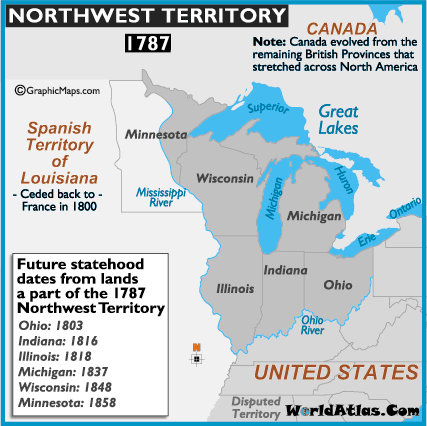
1. The Northwest Territory
Start with the original Northwest Territory, now sometimes referred to as the Great Lakes region. This is the historic core of what we now think of as the Midwest.
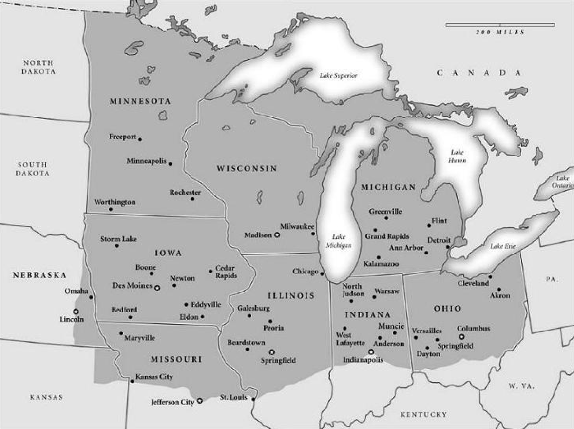
2. Midwest Census Division
The Census Bureau has an official definition of the Midwest, which is one of four so-called “Census Divisions.” This is further divided into two “Census Regions” as in the map below.
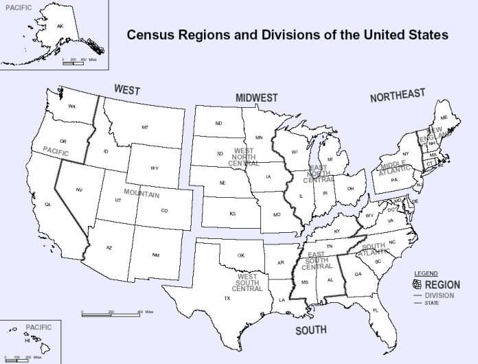
Census Divisions and Regions
Ethnic and Cultural Definitions
Others have attempted to draw maps based on shared ethnicity and culture. These tend to deny the existence of an actual Midwest as we think about it today.
3. Nine Nations of North America
One of the most famous of these is from Joel Garreau, who made a claim that there were actually nine nations on the North American continent in his book of that same name.
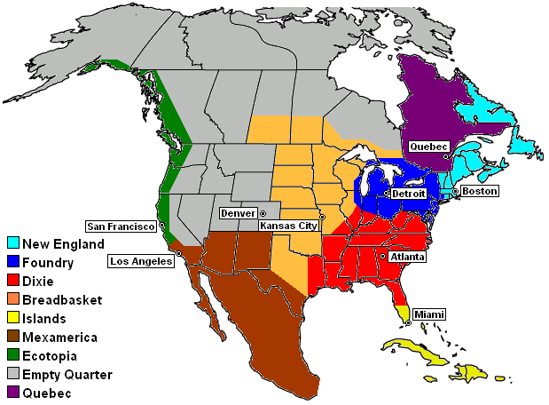
Joel Garreau’s Nine Nations
4. Eleven Nations of North America
Colin Woodard took this a step further and argued that there were really eleven nations in North America, which he identifies based on settlement patterns. You can see his writeup on this in an article in Tufts Alumni magazine.
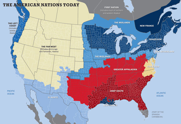
Colin Woodard’s 11 Nations
Economic Definitions
Other maps try to define a region based on shared economic characteristics such as industries.
5. The Rust Belt
Here’s a map of the Rust Belt that’s floating around the I found on a website about coal communities of all places. I’m not sure exactly where it originated.
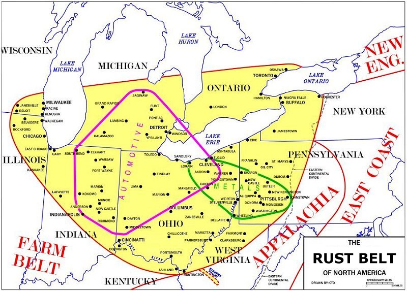
The Rust Belt
Hybrid Definitions
These maps attempt to use both shared cultural/historical and economic characteristics to define a Midwest region.
6. Richard Longworth’s Midwest
In his book Caught in the Middle: America’s Heartland in the Age of Globalism, Richard Longworth created his own bespoke definition of the Midwest. He notably excludes the southern regions of Missouri, Illinois, Indiana, and Ohio as extensions of the south (similar to the 9 & 11 nations map), and also the pure play Great Plains states along the western edge of the Census definition.
Richard Longworth’s Midwest
7. Pete Saunder’s Five Midwests
Pete combines the nations approach with the traditional Census definition of the Midwest in order to divide the Midwest into five sub-regions.
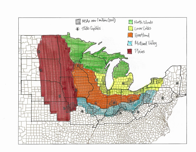
Pete Saunders’s Five Midwests
8. Kotkin’s American Regions and City-States
Joel Kotkin took a similar approach to dividing America up in Forbes magazine. His view also appears to be a hybrid of culture, economics, and history. He turns America into seven regions and three city-states (New York, LA, and Miami). The full map is too huge to blog, but an excerpt is below which you can click on to see the whole thing in a new window.
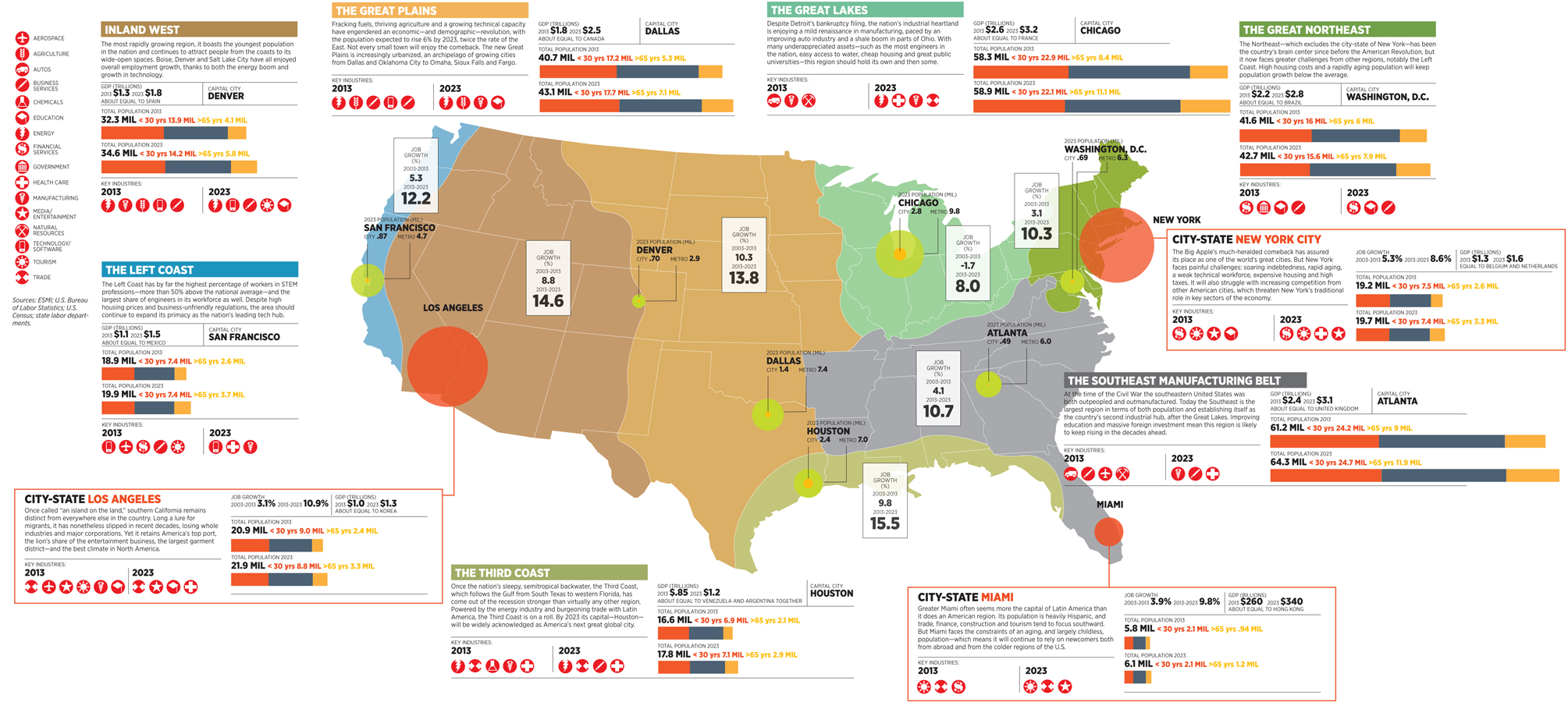
The Midwest in Kotkin’s map
Crowdsourced Maps
A couple of other people used crowdsourcing, in whole or in part, to define the Midwest
9. Walter Hickey/538 Map
Walter Hickey, writing at 538, conducted a survey with Survey Monkey to ask people which states they thought were in the Midwest. Here’s what he came up with.
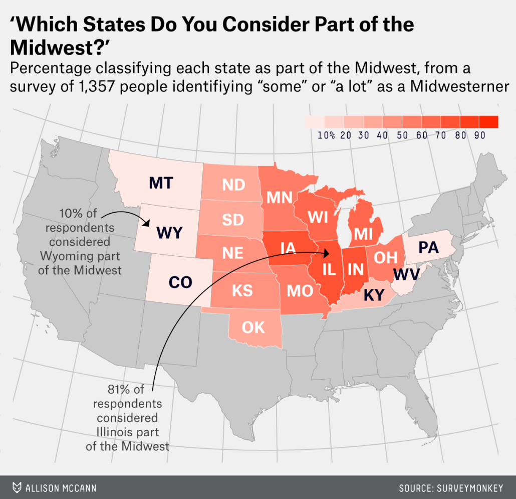
Walter Hickey/538 Map
10. miguecolombia’s Reddit Map
Here’s one that I found on a Reddit thread started by user miguecolombia. It appears to be his personal take on how to divide America, with a strong dose of crowdsourcing from Reddit.

miguecolombia and Reddit’s map
Self-Defining Maps
And a couple maps that try to use statistical techniques to let the Midwest map itself.
11. Facebook Network Maps
Pete Warden took a look at Facebook profiles and connections to create clusters of regions. Most of what we’d think of as the Midwest he called Stayathomia, which also covers much of New England.
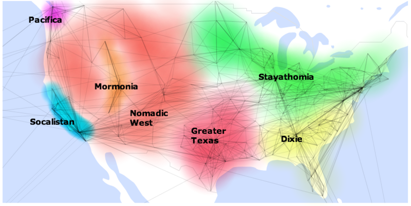
Pete Warden’s Map
12. Chicago Migration Map
Lastly, a special surprise – a map you’ve never seen before. This was created by someone named Daniel Jarratt, who emailed it to me back in 2012. Using Chicago as the capital of the Midwest, he used IRS migration data and a statistic technique called modularity to divide the US into regions based on affinity with Chicago. Darker red means more connection to Chicago and thus in a sense more Midwest.
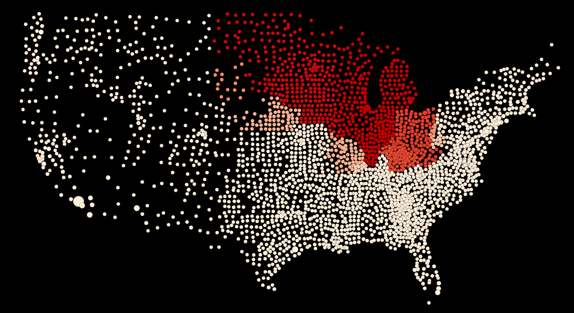
Daniel Jarratt’s Midwest
Aaron M. Renn is a senior fellow at the Manhattan Institute and a Contributing Editor at City Journal. He writes at The Urbanophile, where this piece originally appeared.
Top photo by Benjamin Reed (flying over the midwestUploaded by France3470) [CC BY-SA 2.0], via Wikimedia Commons


