
The 25 million residents of the world’s fourth largest city (urban area) can rest a bit easier, as the Taal volcano has become less threatening in the last few days. But there is still severe disruption, especially for the many people who have been forced to evacuate.
This article includes a brief description of the developments since the January 20 eruption and compares Manila to other major metropolitan areas also threatened by dangerous volcanoes (Seattle and Naples).
The Taal Volcano
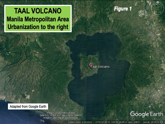
The Taal volcano is small by international standards, rising to only 300 meters (1,020 feet). This compares to the 3,000 to more than 6,000 meter elevations (10,000 to more than 20,000 feet) of the most famous volcanoes in the “Ring of Fire,” stretching from southern Chile, up the eastern Pacific coast to Alaska, along the Aleutian Islands and down the western Pacific to Indonesia and New Zealand. Taalwas in a crater lake, until it was emptied by the eruption. It is within an island (Volcano Island), which itself is in the larger Taal Lake which fills a much larger caldera(15 by 20 kilometers or 9 by 12 miles). TaalLake itself is little above sea level, and within 8 kilometers (5 miles) off the shore of Luzon Island, which has the largest population in the Philippines (Figure 1).
The caldara was formed more than 5,000 years ago, when Taal, then much larger, exploded. There are additional volcanic vents underwater in Taal Lake and on Volcano Island. Taal is the second most active volcano in the Philippines.
Manila's Massive Urbanization
Taal is in the province of Batangas, one of six provincial level jurisdictions that can be considered to comprise the Manila metropolitan area (labor market). The other jurisdictions are Rizal, Cavite, Laguna, Bulucan and the National Capital Region (NCR).
The extent of Manila’s urbanization has largely been missed in press reports on the volcano. There are references to “Metro Manila,” with its 13 million people being close by. But Metro Manila is the National Capital Region, and only a part of the metropolitan area, just as the District of Columbia is only a part of the Washington metropolitan area. Only the Tokyo-Yokohama, Jakarta and Delhi urban areas have larger populations than Manila.
The metropolitan area, which includes the urban area, and economically connected adjacent areas covers only one-half the land area of the New York metropolitan area, but has a 40 percent higher population (28.5 million v. 20.2 million in 2015).
“Decade Volcanoes:” Manila and Elsewhere
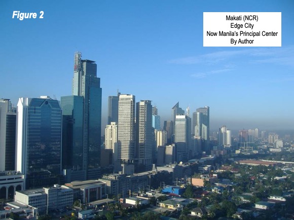
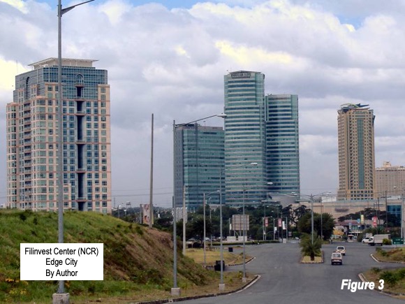
The Taal volcano is one of the 16 “decade volcanoes,” as designated by the International Association of Volcanology. The decade volcanoes are the sixteen most dangerous volcanoes in the world due to their proximity of populated areas and history of violent eruptions. Manila is by far the largest urban area so close to a decade volcano. Within 100 kilometers (70 miles) of the volcano there is a population of more than 30 million. The historic core of Manila is 65 kilometers (40 miles) from the volcano, and some of its many Edge Cities (45 kilometers or 28 miles) are even closer, including the now principal center of Makati (Figure 2) and Filivest (Figure 3).
Other well - known decade volcanoes include Mount Rainier, in the Seattle area and Mount Vesuvius in the Naples area, both of which are discussed below.
Seattle and Mount Rainier: There is considerable concern about the danger that a Mount Rainier eruption could threaten for the Seattle urban area (Figure 4).
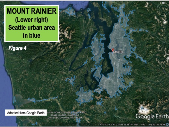
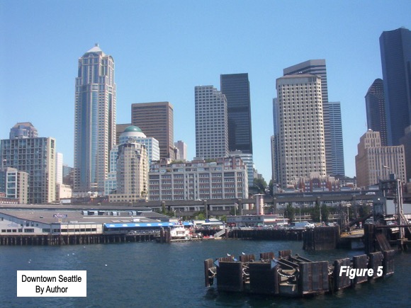
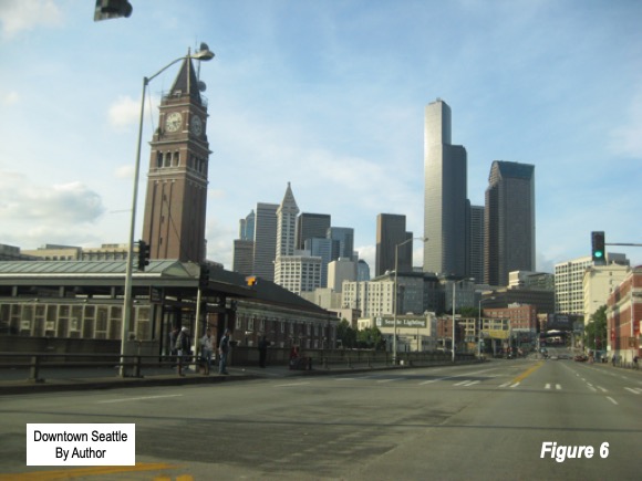
It is nearly 25 miles to the closest part of the urban area, though the threat from mud flows could be devastating (See: Mount Rainier’s Oscela Mudflow video at YouTube). Downtown Seattle is about 100 kilometers (60 miles) from Rainier’s summit (Figures 5 & 6). There are about four million residents within a 110 kilometer radius, little more than one-tenth the Manila figure.
Naples and Mount Vesuvius: Mount Vesuvius is surrounded by the urbanization of Naples (Figure 7) Vesuvius has by far the largest nearby population, with a circle of urbanization reached within a five kilometer radius (three miles) of the crater (Figure 7). This is smaller than the Taal caldara. The urban core is far closer than in Manila or Seattle (Figure 8), at only 14 kilometers (9 miles). But like Seattle, the population within a 110 kilometer radius is much smaller than in Manila, at less than 7 million.
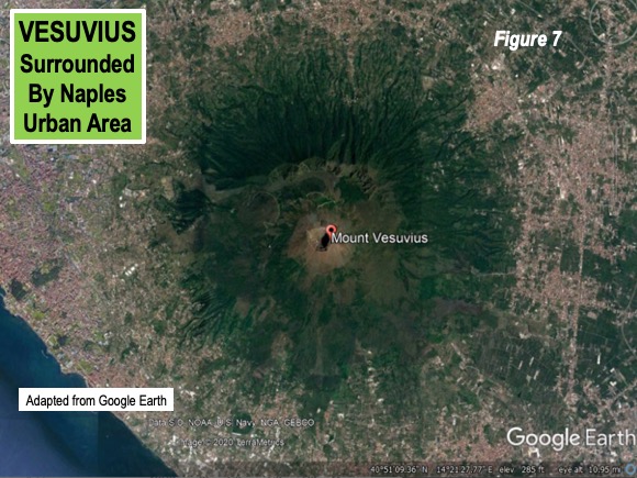
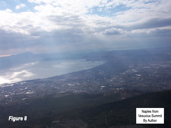
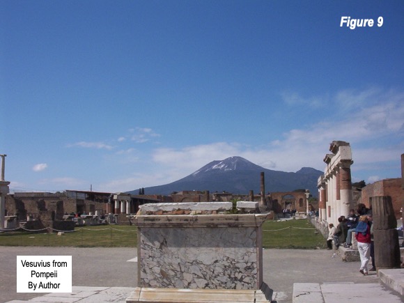
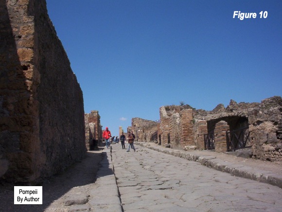
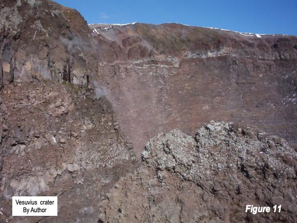
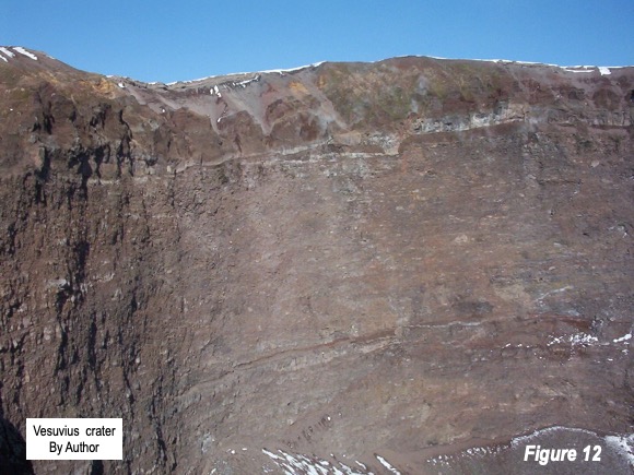
Figure 9 shows a view of Vesuvius from Pompeii, which it destroyed in 44 A.D., on the opposite side of the mountain from the urban core (also Figure 10). Figures 11 and 12 show the interior of the crater.
Nearby Urbanization
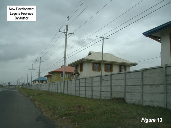
The fastest growing part of the Manila urban area is in the vast suburban areas of Laguna and Cavite provinces. Some of the newer development (and some older) is within 10 miles of Taal (Figure 13). While that is a large perimeter, a serious eruption would be capable of huge devastation in both urban areas.
On Sunday, January 12, Taal’s most recent eruptive activity and by Sunday night volcanic ash had fallen throughout the Manila metropolitan areas and even beyond. Fissures (cracks) have since developed in municipalities beyond the shores of Lake Taal. Manila’s main airport (Ninoy Aquino International Airport) was temporarily closed because of the ash. Evacuations have been required from municipalities outside Lake Taal and currently there are more than 170,000 evacuees. Most of these live in municipalities outside the caldara, but there were also residents on Volcano Island, whom the government says will not be permitted to live there any longer.
Threat of an Explosive Eruption
The Alert level was raised to 4 last week, just one short of the highest level of 5.According to the Philippine Institute of Volcanology and Seismology (Dost-PHIVOLCS), “This means that hazardous explosive eruption is possible within hours to days. DOST-PHIVOLCS strongly reiterates total evacuation of Taal Volcano Island and high-risk areas as identified in the hazard maps within the 14-km radius from Taal Main Crater and along the Pansipit River Valley where fissuring has been observed.”
Officials continue to express concern that there is still the threat of a “hazardous explosive eruption.” The current eruptions may or may presage a much more serious eruption. Obviously, everyone hopes that it does not.
Photograph: Exec8 - own work; Taal Volcano, January 12, 2020 eruption, via Wikimedia under CC 4.0 License.
Wendell Cox is principal of Demographia, an international public policy and demographics firm. He is a Senior Fellow of the Center for Opportunity Urbanism (US), Senior Fellow for Housing Affordability and Municipal Policy for the Frontier Centre for Public Policy (Canada), and a member of the Board of Advisors of the Center for Demographics and Policy at Chapman University (California). He is co-author of the "Demographia International Housing Affordability Survey" and author of "Demographia World Urban Areas" and "War on the Dream: How Anti-Sprawl Policy Threatens the Quality of Life." He was appointed by Mayor Tom Bradley to three terms on the Los Angeles County Transportation Commission, where he served with the leading city and county leadership as the only non-elected member. Speaker of the House of Representatives appointed him to the Amtrak Reform Council. He served as a visiting professor at the Conservatoire National des Arts et Metiers, a national university in Paris.


