
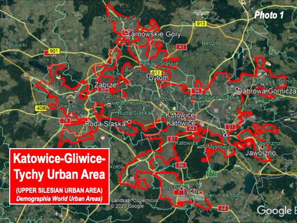
Katowice-Gliwice-Tychy (hyperlinks are audio pronunciations) is fast-developing Poland’s second largest continuously developed urban area (urban agglomeration), with 1.7 million residents. Only the Warsaw urban area has a larger population, at 1.9 million), according to the 2020 edition of Demographia World Urban Areas. The urban area covers 675 square kilometers (261 square miles and has a population density of 2,550 per square kilometer, or 6,613 per square mile (Photo 1). The area is also referred to as the Upper Silesian urban area.
A Genuine Conurbation
Katowice-Gliwice-Tychy is a genuine conurbation, an urban area formed by the merging of separate urban areas into one. Continuous urban areas have no rural territory. Unlike conurbations, most urban areas are formed as a larger urban area engulfs smaller suburbs, exurbs and rural areas. In a conurbation, there is usually no overly dominant core municipality. The largest conurbation in the world is Osaka-Kobe-Kyoto, where four historic cities (including Naha) have expanded and merged together, especially since World War II.
Katowice-Gliwice-Tychy is similar to another much larger conurbation, Germany’s Essen-Dusseldorf (the “Rhine-Ruhr”), which has more than three times as many residents (6.1 million). Both conurbations have been the leading industrial areas of their nations and major centers of coal and steel production. Other similarities will be discussed below.
The Urban Form
The largest municipality in the urban area, Katowice has about 1/6th of the population, at just below 300,000 residents. Four other municipalities have populations above 150,000, including Sosnoweic, Gliwice, Zabrze and Bytom. All of the largest cities have lost population in recent years. Katowice reached its peak population of about 370,000 in 1987, with the latest city estimate (2019) down more than 20% to 292,000.
This is also similar to the Essen-Dusseldorf urban area, where the three largest municipalities each have approximately 10% of the population, while 70 % are in smaller municipalities.
The urban area is principally linear, stretching is 55 kilometers east to west (33 miles), somewhat less than the east-west orientation of Essen Dusseldorf.
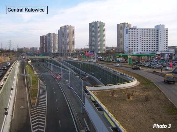
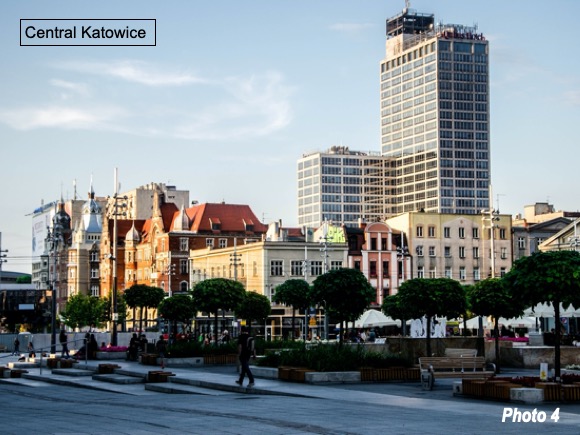
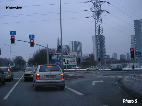
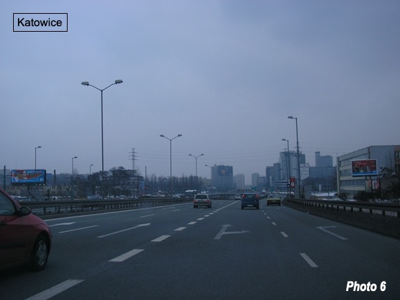
With its heavy industrial and mining economy, Katowice-Gliwice-Tychy has a multitude of factory buildings. But there has also been considerable redevelopment of the area. The photograph above shows the Silesian City Center, which is a large enclosed mall in the core of Katowice, and opened in 2005. Modern development is also evident in Photos 3 to 6.
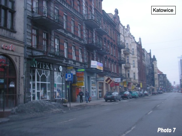
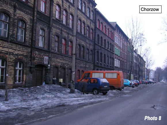
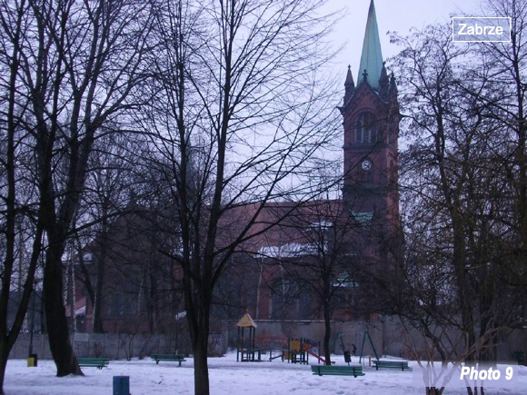
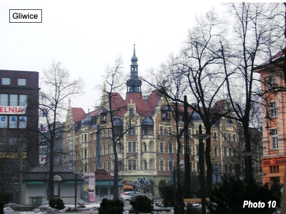
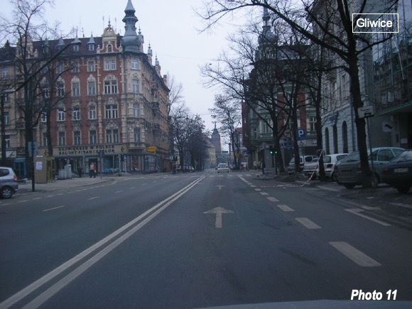
Heritage development is illustrated in Photos in Katowice, Chorzow, Zabrze (called Hindenberg between World War I and World War II) and Gliwice (Photos 7 to 11).
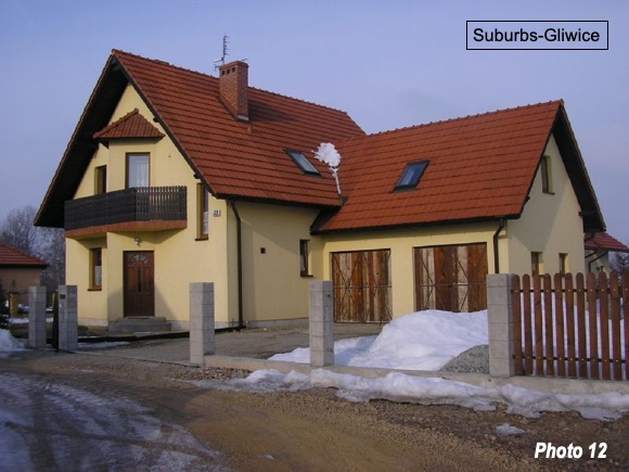
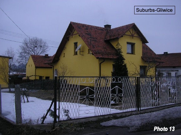
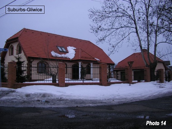
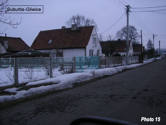
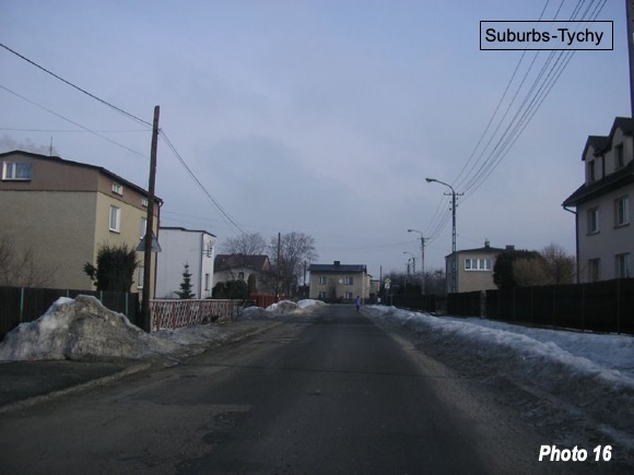
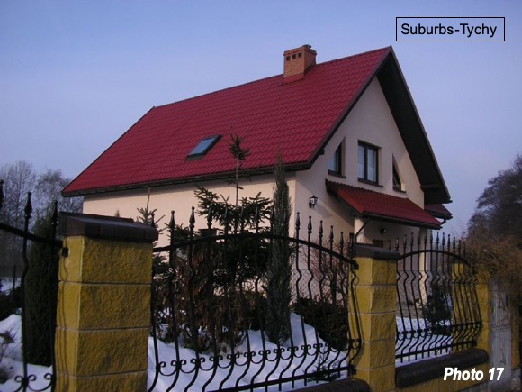
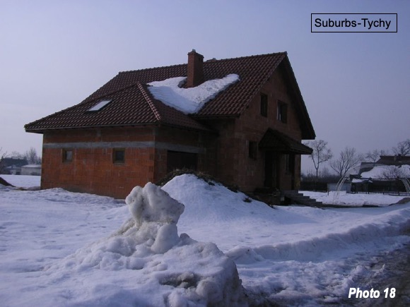
Like virtually all European urban areas, Katowice-Gliwice-Tychy has developed large suburban areas. Suburban housing is illustrated in Photos 12-18.
Historical Significance
Katowice-Gliwice-Tychy has had historical significance. In 1742, the area was ceded by Austria to Prussia, after the First Silesian War and was a part of the unified Germany that emerged before World War I. The Upper Silesian Urban Area was the southeastern most extension of Germany, with Krakow in the Austro-Hungarian Empire, only 80 kilometers (50 miles away), while the Russian Empire extended to within 50 kilometers (30 miles) of both Katowice and Krakow (to the north and east).
After the German defeat, the Republic of Poland was established by the Treaty of Versailles, but the sovereignty over some border areas were not firmly established. Such as Upper Silesia. In the early 1920s, after uprisings and instability, the area was split between Germany and Poland, with western municipalities, such as Gliwice, Bytom and Zabrze becoming German, while Katowice became Polish.
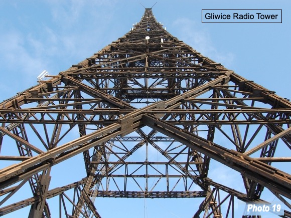
The opening salvos of World War II in Europe began on September 1, 1939, as Germany invaded Poland, claiming that there had been an armed provocation by Poland on the previous day. The reality is that the provocation had been a ruse by a German force attired in Polish uniforms on a radio tower in Gliwice (Photo 19).
In another similarity, the Essen-Dusseldorf conurbation also made history before World War II, as it had been included in the demilitarized Rhineland, under the Treaty of Versailles. One of the most important events leading up to World War II was the reoccupation of the Rhineland by Germany.
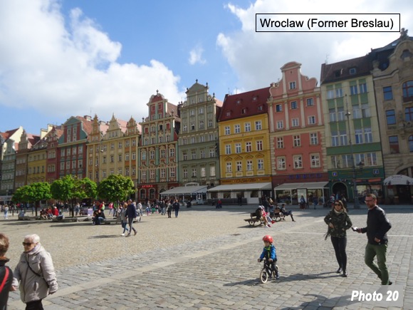
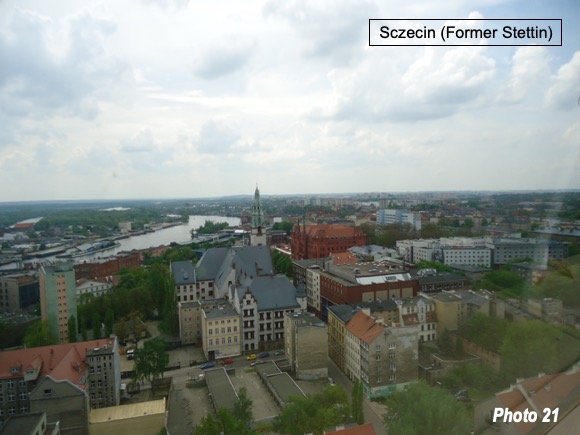
After World War II, Poland was re-established and the entire Katowice-Gliwice-Tychy urban area was placed in Poland, in part to make up to eastern lands ceded to Stalin’s Soviet Union. Poland’s westward expansion went to the Oder River, under the Potsdam Agreement. This area included now Polish named Wroclaw (formerly Breslau, Photo 20), 170 kilometers (110 miles) to the west of Katowice. Baltic port Szczecin (formerly Stettin) was also added to Poland (Photo 21). At the same time, a Soviet annexation of an even larger area of Poland was included in the Potsdam agreement.
In a footnote to Cold War history, the city of Katowice was renamed Stalinogrod, in honor of Soviet leader Josef Stalin following his death in 1953. This change was reversed in 1956. More recently, with the collapse of the Communist regime in 1989 times have fared better for Poland.
Transforming the Silesian Region
Katowice is the capital of the Silesian province (Voivodeship), which has the second largest population (4.5 million) and greatest urbanization percentage in Poland. The province, like the Rhine-Ruhr and other coal producing areas of the world has seen substantial declines in mining and will need to rely on other sectors to remain prosperous. Mining has dropped as a share of the provincial economy from 9.7% in 2000 to 6.9% in 2019.
But as in other parts of central or eastern Europe, the economy is changing. CBRE has ranked the Katowice cluster (Silesian province, which includes the entire Katowice-Gliwice-Tychy urban area) as the sixth strongest high-tech growth cluster in Europe (out of 281 NUTS 2 regions of Europe). To qualify for the top ten, a tech cluster must have had double digit growth since 2010, with a projection for growth in the next five years. This is an important sign of economic transformation and progress.
Poland, whose history is marked by tragedy, has been on the ascendancy and the Upper Silesian urban area has been an important part of that change.
Photo credits: lead photo of Silesia City Center, Katowice via Wikimedia; Photo 3, by Jan Mehlich via Wikimedia; Photo 19 by Andrzej Jarczewski via Wikimedia under CC 3.0 License. Photo 4, by thepoweroflight via Wikimedia under CC 4.0 License. Other photos by author, except photo 1 from Google Earth.
Wendell Cox is principal of Demographia, an international public policy firm located in the St. Louis metropolitan area. He is a founding senior fellow at the Urban Reform Institute, Houston and a member of the Advisory Board of the Center for Demographics and Policy at Chapman University in Orange, California. He has served as a visiting professor at the Conservatoire National des Arts et Metiers in Paris. His principal interests are economics, poverty alleviation, demographics, urban policy and transport. He is co-author of the annual Demographia International Housing Affordability Survey and author of Demographia World Urban Areas.
Mayor Tom Bradley appointed him to three terms on the Los Angeles County Transportation Commission (1977-1985) and Speaker of the House Newt Gingrich appointed him to the Amtrak Reform Council, to complete the unexpired term of New Jersey Governor Christine Todd Whitman (1999-2002). He is author of War on the Dream: How Anti-Sprawl Policy Threatens the Quality of Life and Toward More Prosperous Cities: A Framing Essay on Urban Areas, Transport, Planning and the Dimensions of Sustainability.


