Two interesting statistics were recently released in the same week. Singapore clocked in a population of just over 5 million and a sex ratio of 974 males per 1000 females. Its neighbour and ally India inched closer to beating China in the population game by notching up 1,210 million people as its head count, along with the more news-worthy sex ratio of 940 females to every 1000 males. read more »
Urban Issues
Washington State's Evolving Demography
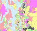
Population change in the state of Washington has relevance to the nation and to other states because it tells us something about market preferences of households versus the orientation of planners (e.g., “smart growth”). It tells us much about gentrification and America’s changing racial and ethnic diversity. read more »
The Evolving Urban Form: Manila
The Urban Area: The Manila urban area ranks as the world's fifth largest urban area (area of continuous urban development) with a population of approximately 21,000,000 (Note 1) covering a land area of 550 square miles (1,425 square kilometers). The urban population density sits at approximately 38,000 people per square mile (14,500 per square kilometer). read more »
Pickles Plans a Pogrom
Pogróm is a word with Yiddish origin, and is a Russian word meaning “to wreak havoc, to demolish violently, to destroy, or to devastate a town."
Eric Pickles, British Secretary of State for Communities and Local Government, is planning to demolish, destroy, and devastate half of Dale Farm, on Oak Lane, Crays Hill, near Billericay. read more »
Here Comes the Bus: America’s Fastest Growing Form of Intercity Travel
Travel by intercity bus is growing at an extraordinary pace: reflecting a rise in travel demand, escalating fuel prices, and investments in new routes. This confluence of factors has propelled scheduled bus service between cities to its highest level in years and has made the intercity bus the country’s fastest growing mode of transportation for the third year in the row. read more »
Downtown China
In Downtown: It's Rise and Fall, 1880-1950, Robert M Fogelson says that downtowns are a uniquely American phenomenon. He refers to downtown as the commercial cores with high building densities that form "canyons" that, in some smaller urban areas, might be only a block long to a mile or more long. Fogelson demonstrates that downtowns in the United States are largely a creation of rail transit (subways or metros, street cars and their predecessor horse cars). read more »
Malthusian Delusions Grip Australia
Entrepreneur Dick Smith wants Australian families to be subject to China-like population doctrine. Families should be limited to just two children, the father of two and grandfather of six says, because our population growth is something like ‘a plague of locusts.’
Yet in reality, as in many other advanced countries, our population crisis may have more to do with having too few --- specifically younger --- people than too many. read more »
The Census’ Fastest-Growing Cities Of The Decade
Over the past decade urbanists, journalists and politicians have hotly debated where Americans were settling and what places were growing the fastest. With the final results in from the 2010 Census, we can now answer those questions, with at least some clarity.
Not only does the Census tell us where people are moving, it also gives us clues as to why. It also helps explain where they might continue to go in the years ahead. This information is invaluable to companies that are considering where to expand, or contract, their operations. read more »
Los Angeles: The MTA's Bus Stop Strategy
Those who run the Los Angeles Metropolitan Transportation Authority evidently believe that, since the Consent Decree that forced it to improve service to its bus riders has expired, they are free to rewrite history to justify Metro's elimination of nine bus lines, its reductions in service on eleven more, and its overall elimination of four percent of its bus service hours by attempting to show that MTA bus service is little utilized and not cost-effective. read more »
The Evolving Urban Form: Dallas-Fort Worth
The Dallas-Fort Worth metropolitan area (Note 1), which corresponds to the Dallas-Fort Worth urban area, provides a casebook example of expanding urbanization. Dallas-Fort Worth has been one of the fastest growing major metropolitan areas in the nation for decades. Dallas-Fort Worth was among only three US metropolitan areas adding more than 1,000,000 residents between 2000 and 2010. Only Houston's addition of 1,230,000 exceeded that of Dallas-Fort Worth, which grew by 1,210,000, a 23.4 percent growth rate. read more »


