Evolving Urban Form: Development Profiles of World Urban Areas

The Evolving Urban Form: Chongqing

chongqing2.JPG

No city in the world is so misunderstood by analysts and the press. It is commonly asserted Chongqing is the largest city in the world. In reality it barely makes the top 50, ranking 47th.

Cities (Shi) in China are Regions and Mostly Rural

It is fundamentally a problem of semantics and a failure to comprehend the nuances of urban geography in China. The country is divided into provinces and their equivalents, which are in turn, divided into prefectures, most of which are "shi," "Shi" translates into English as "city."  read more »
The Evolving Urban Form: Philadelphia

450px-Philadelphia_City_Hall_-_2.jpg

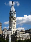
Philadelphia was America's first large city and served as the nation's capital for all but nine months between the inauguration of George Washington is the first president in 1789 and the capital transferred to Washington, DC in 1800.

Before the early 1900s, the United States Census Bureau had not developed a metropolitan area (labor market area) concept. However, the website peakbagger.com has attempted to define earlier metropolitan areas based on concepts similar to those used today. In the case of Philadelphia, this is important, because it was somewhat unique in having virtually adjacent, highly populated suburbs that make comparisons of municipal populations (the only population data available) misleading.  read more »

The Evolving Urban Form: Suburbanizing Mexico

guadalajara.jpg

There is an increasing recognition – at least outside the academy, planning organization and urban core developer groups – that the spatial expansion of cities or suburbanization represents the evolving urban form of not only the United States and virtually all of the high income world but also across the developing world, whether middle income or third world.  read more »

The Evolving Urban Form: The San Francisco Bay Area

sf-evolve.JPG

Despite planning efforts to restrict it, the Bay Area  continues to disperse. For decades, nearly all population and employment growth in the San Jose-San Francisco Combined Statistical Area has been in the suburbs, rather than in the core cities of San Francisco and Oakland. The CSA (Note) is composed of seven adjacent metropolitan areas (San Francisco, San Jose, Santa Cruz, Santa Rosa, Vallejo, Napa, and Stockton). A similar expansion also occurred in the New York CSA.  read more »

The Evolving Urban Form: Charlotte

800px-Charlotte_uptown_Aerial.jpg

There may be no better example of the post World War II urban form than Charlotte, North Carolina (a metropolitan area and urban area that stretches into South Carolina). Indeed, among the approximately 470 urban areas with more than 1 million population, Charlotte ranks last in urban population density in the United States (Figure 1) and last in the world. According to the United States Census Bureau, Charlotte's built-up urban area population density was 1685 per square mile (650 per square kilometer) in 2010.  read more »

The Evolving Urban Form: Greater New York Expands

manhattan-59th-st.JPG

The term “Greater New York” was applied, unofficially, to the 1898 consolidation that produced the present city of New York, which brought together the present five boroughs (counties). The term “Greater” did not stick, at least for the city. When consolidated, much of the city of New York was agricultural. As time went on, the term "Greater" came to apply to virtually any large city and its environs, not just New York and implied a metropolitan area or an urban area extending beyond city limits.  read more »

The Evolving Urban Form: Portland

mt hood.PNG

Among urban planners, there is probably not a more revered urban area in the world than Portland (Oregon). The Portland metropolitan area and its core urban area , principally located in Oregon, stretches across the Columbia River into the state of Washington (Figure 1). Nearly four decades ago, the state of Oregon adopted strong urban planning requirements, including the requirement of an urban growth boundary.  read more »

The Evolving Urban Form: The Rhine-Ruhr (Essen-Düsseldorf)

651px-Wuppertaler_Schwebebahn_in_Elberfeld.jpg

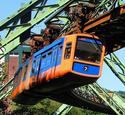
Rhine-Ruhr, or Essen-Düsseldorf, is among the world's least recognized larger urban areas (Figure 1).  Germany does not designate urban areas according to the international standard, and for that reason the Rhine-Ruhr does not appear on the United Nations list of largest urban areas. Yet, in reality this contiguous urban area is Germany's largest urban area, a position as it has held since at least the end of World War II. The Rhine-Ruhr is the third largest urban area in Western Europe, trailing only Paris and London.  read more »

The Evolving Urban Form: Toronto

cox-toronto-evolve.png

Toronto is the largest city (metropolitan area) in Canada and its principal commercial center. However, this is a relatively recent development. Toronto displaced Montréal is Canada's largest city during the 1960s. Since the 1971 census, when the two Metropolitan areas were nearly identical size, Toronto has added approximately 3 million people, while Montréal has added approximately 1,000,000 (Figure 1).  read more »

The Evolving Urban Form: Nanjing

nanjing-lead.JPG

Nanjing is one of China's most historic cities. It is one of the four great ancient capitals of the nation, along with Beijing, Chang'an (Xi'an) and Luoyang. Its name means southern capital (Nan=south, Jing=capital), while the name of the current capital, Beijing means Northern capital.  read more »