In 1997, Metro — Portland’s regional planning agency — issued its 2040 plan to guide the region for the next several decades. The plan was supposed to be in response to a 1995 Future Vision statement written by a group of citizens. Now Metro revising the Future Vision and its plans, but a close look at the region reveals that it should completely scrap the planning process.
The 1995 Future Vision called for “housing affordable for all,” “accessible employment centers throughout the region,” “equitable economic progress,” “public safety,” and reductions in poverty. By all of these measures, the region is worse today than it was in 1997, and this decline is almost entirely due to Metro’s 2040 plan.
As noted in comments submitted to Metro by the Cascade Policy Institute (and which I wrote), Portland housing has gone from expensive in 1995 to unaffordable today — under standard mortgage rules, a median-income family cannot get a mortgage on a median-value home. This has increased wealth inequality. For example, the disparity between white and black homeownership rates grew from 25 to 30 percentage points.
Far from making employment centers more accessible, Metro’s anti-auto stance has increased congestion by 75 percent. Instead of relieving congestion, Metro has been building light rail, which doesn’t adequately serve any employment centers but downtown. While 28 percent of downtown workers took transit to work before the pandemic, less than 5 percent of workers in the rest of the region commuted by transit. Since only about 11 percent of Portland workers worked downtown (and far less today), it is no wonder that transit’s share of commuting has declined and, after Portland’s most recent (and most expensive) light-rail line opened in 2016, total transit ridership dropped.
Meanwhile, public safety has declined and high housing costs have increased poverty and homelessness. To make matters worse, Portland has some of the highest tax rates in the nation thanks to the need to pay for light rail, affordable housing, regional parks, and other Metro schemes.
Worst of all, Metro had a pretty good idea these things were going to happen as early as 1993. In that year, Metro reviewed data for the nation’s 50 largest urban areas to see which came closest to the model for what it planned for Portland. The answer was Los Angeles, which had the highest population density and fewest miles of freeways per capita of any major urban area, and which was also embarking on a program of building or operating nearly 500 miles of rail transit lines.
“In public discussions we gather the general impression that Los Angeles represents a future to be avoided,” commented Metro in that 1993 analysis. Yet “with respect to density and road per capita mileage it displays an investment pattern we desire to replicate.”
Instead of realizing this meant there was something wrong with its plan, Metro decided Portlanders didn’t appreciate how wonderful Los Angeles really was, with some of the worst congestion and least affordable housing in the country.
Read the rest of this piece at The Antiplanner.
Randal O'Toole, the Antiplanner, is a policy analyst with nearly 50 years of experience reviewing transportation and land-use plans and the author of The Best-Laid Plans: How Government Planning Harms Your Quality of Life, Your Pocketbook, and Your Future.
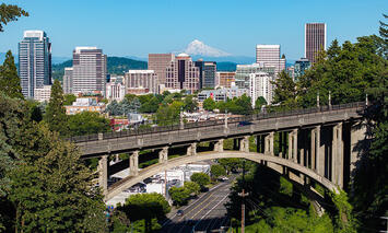
Photo: Downtown Portland and Mount Hood with the Vista Avenue Bridge — often called the Suicide Bridge — in the foreground. Portland’s quality of life has declined so much in the last 30 years that it is almost as if the city is trying to commit suicide. Source: Spicypepper999 via Wikimedia in Public Domain.


